Quick Facts
- Distance: 31 miles (50 km).
- Official Route: State Route 254.
- Location: Humboldt Redwoods State Park, approximately 4.5 to 5 hours north of San Francisco.
- Total Old-Growth: 17,000 acres of protected coastal redwoods.
- Admission: Free to drive; no park entrance fee for the main highway.
- Top Landmark: Founders Grove and the fallen Dyerville Giant.
- Best Time to Visit: Late spring through early fall for clear roads and ideal light.
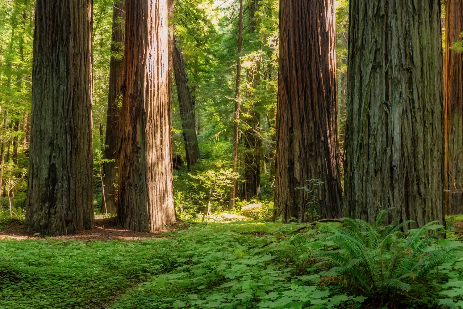
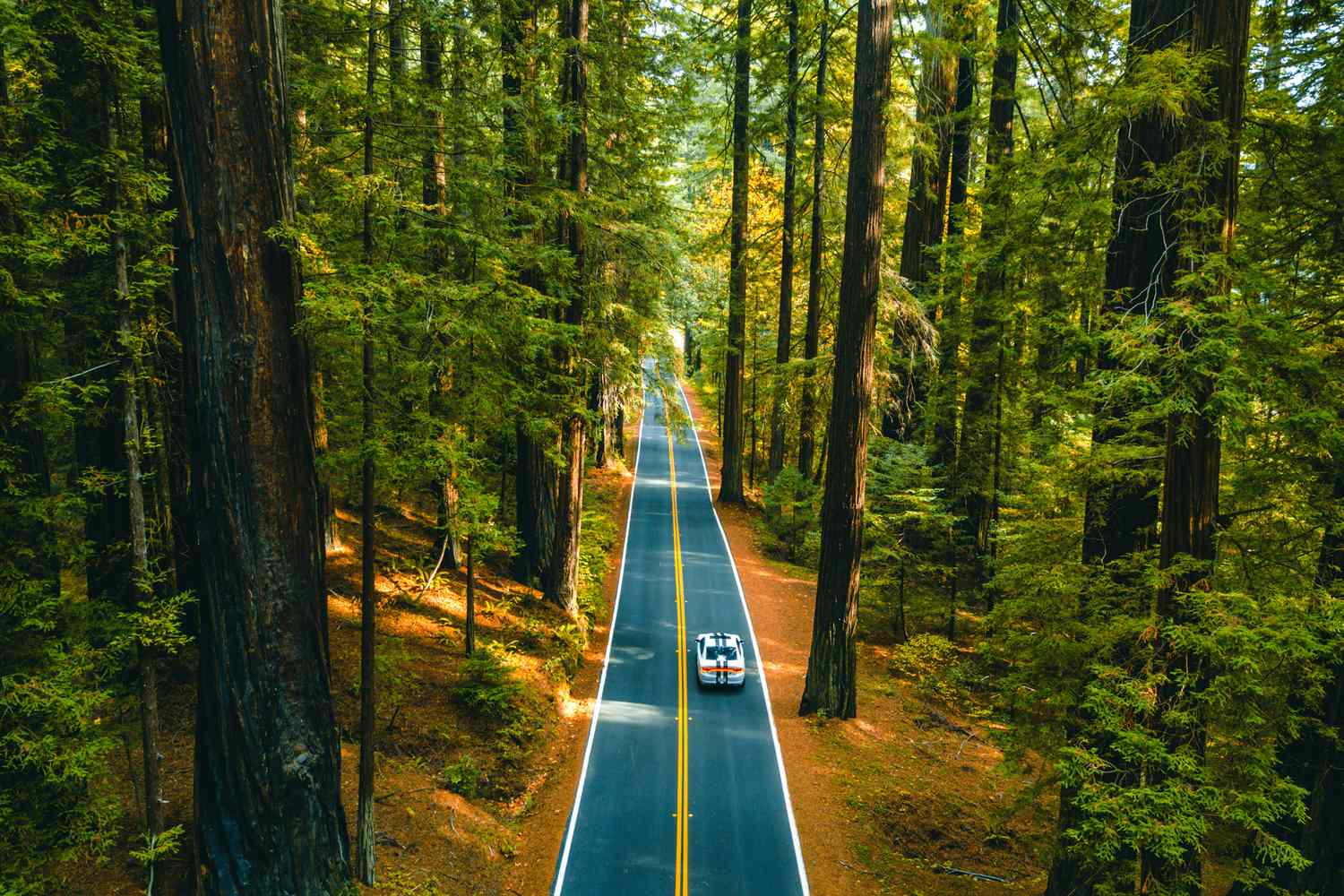
The Avenue of the Giants is a 31-mile scenic highway located within Humboldt Redwoods State Park in Northern California, officially designated as State Route 254. This iconic route parallels Highway 101 and follows the winding path of the Eel River, traversing the world's largest contiguous old-growth coastal redwood forest, stretching from Phillipsville in the south to Pepperwood in the north.
Exploring the Great Redwood Legacy
Few stretches of asphalt in North America command as much reverence as State Route 254. Driving the Avenue of the Giants is not merely a transit through a forest; it is a journey through a prehistoric cathedral where the living columns reach heights that challenge the imagination. As a destinations editor, I have found that while many visitors rush to the more famous national parks further north, the most intimate and profound redwood experience often happens right here in the Eel River Valley.
The history of this road is deeply intertwined with the early conservation movement. Originally a portion of U.S. Route 101, the road was bypassed by the modern freeway to preserve the groves and provide a slower, more immersive experience. It was officially designated as a scenic parkway by the state of California on August 27, 1960, ensuring that future generations could experience these 17,000 acres of old-growth coastal redwoods without the roar of interstate commercial traffic.
The South Entrance: Phillipsville to Myers Flat
For those traveling north from San Francisco, the journey begins at the Phillipsville exit. This southern gateway marks a dramatic transition from the open, oak-studded hillsides of Mendocino County into the deep, shaded ecosystem of Humboldt County. As you move away from the main highway, the temperature often drops by ten degrees, and the light filters through the canopy in narrow, ethereal beams.
One of the first significant stops is the community of Miranda, a charming hamlet that serves as an excellent base for Avenue of the Giants road trip planning. Here, you can find local markets and cafes to stock up on supplies before heading deeper into the groves. Just north of Miranda, the Eternal Tree House offers a fascinating glimpse into the resilience of these trees. It is a room built inside a still-living redwood stump, demonstrating the incredible scale of the species even after its primary trunk has been removed.
Further up the road in Myers Flat, you will encounter the Shrine Drive-thru Tree. While a private attraction with a small fee, it remains one of the most popular Avenue of the Giants must-see stops. It is a natural split in a living tree that allows small vehicles to pass through. Even if you choose not to drive your car through the trunk, the gift shop and surrounding walk-thru trees provide a classic California roadside experience that has changed little since the 1950s.
Digital Survival & Navigation Tips
Before you immerse yourself in the forest, a word of practical caution is necessary. Modern connectivity ends almost the moment you exit Highway 101. You will encounter near-zero cell service and navigation tips for Avenue of the Giants always emphasize the importance of preparation. The dense canopy and steep canyon walls effectively block satellite and cellular signals, meaning your GPS will likely fail between the major towns.
To navigate successfully, download offline maps of the entire Humboldt County region before you leave Garberville or Fortuna. I also recommend stopping at the first trailhead you see—such as Bolling Grove—and taking a high-resolution photograph of the physical map boards. These boards provide detailed information on scenic pullouts and restroom locations that digital maps often omit. Relying on an old-school paper brochure or a photographed trailhead map is a rite of passage for every traveler on this route.
Heart of the Forest: Founders Grove & Rockefeller Forest
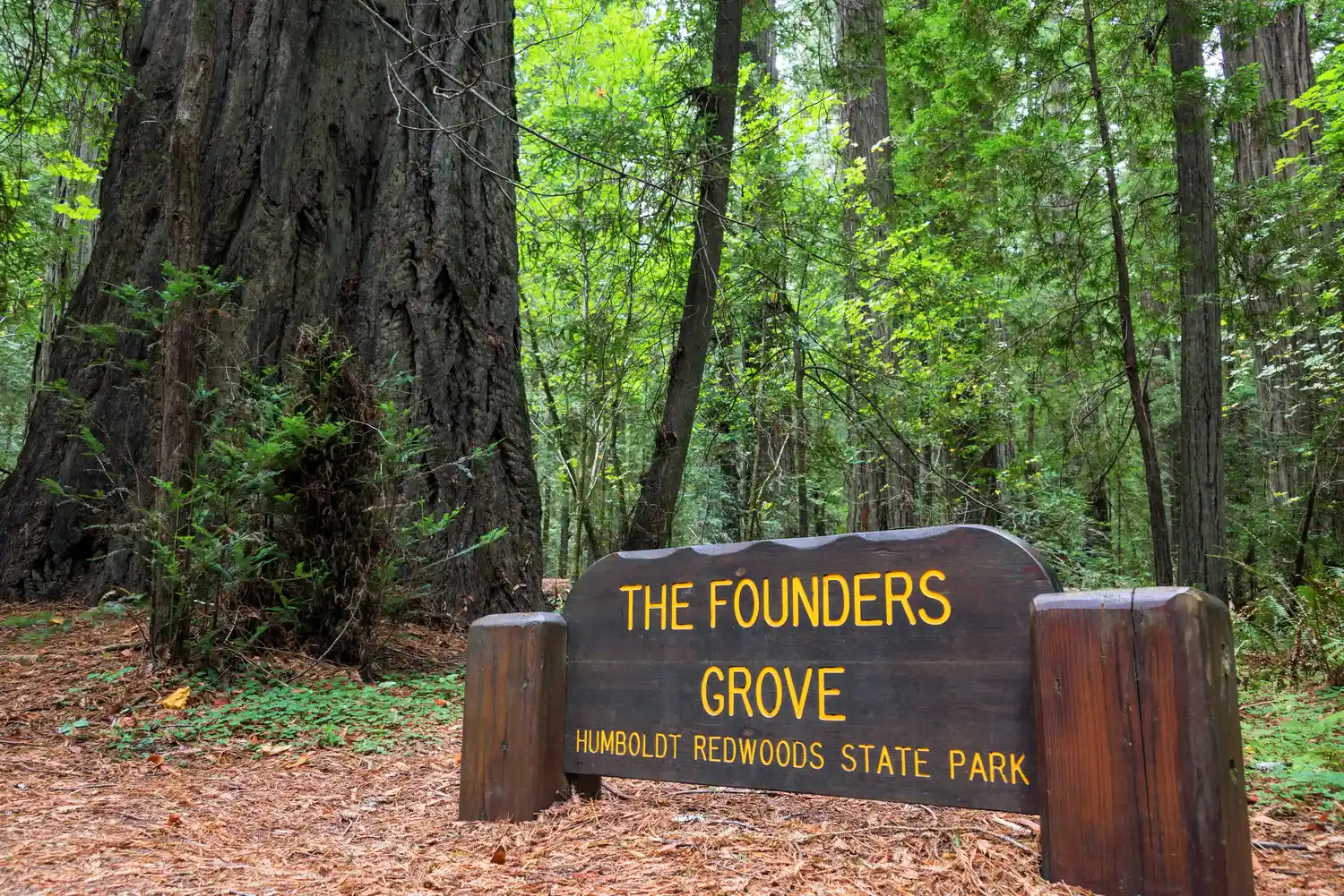
The true center of the park lies near the confluence of the South Fork and the Main Stem of the Eel River. This area contains the highest concentration of record-breaking trees and the most significant Humboldt Redwoods State Park attractions. Founders Grove is the crown jewel of the park, featuring an accessible half-mile loop that leads to the Dyerville Giant.
The Dyerville Giant was once considered the tallest tree in the world before it fell during a winter storm in 1991. Today, it lies on the forest floor, a horizontal behemoth that allows visitors to walk its length and truly comprehend its nearly 370-foot stature. It is a sobering reminder of the natural cycle of the old-growth ecosystem. In this same area, you will find the Julia Morgan Hearthstone, a beautiful stone fireplace designed by the legendary architect of Hearst Castle, located at the Women’s Clubs Grove.
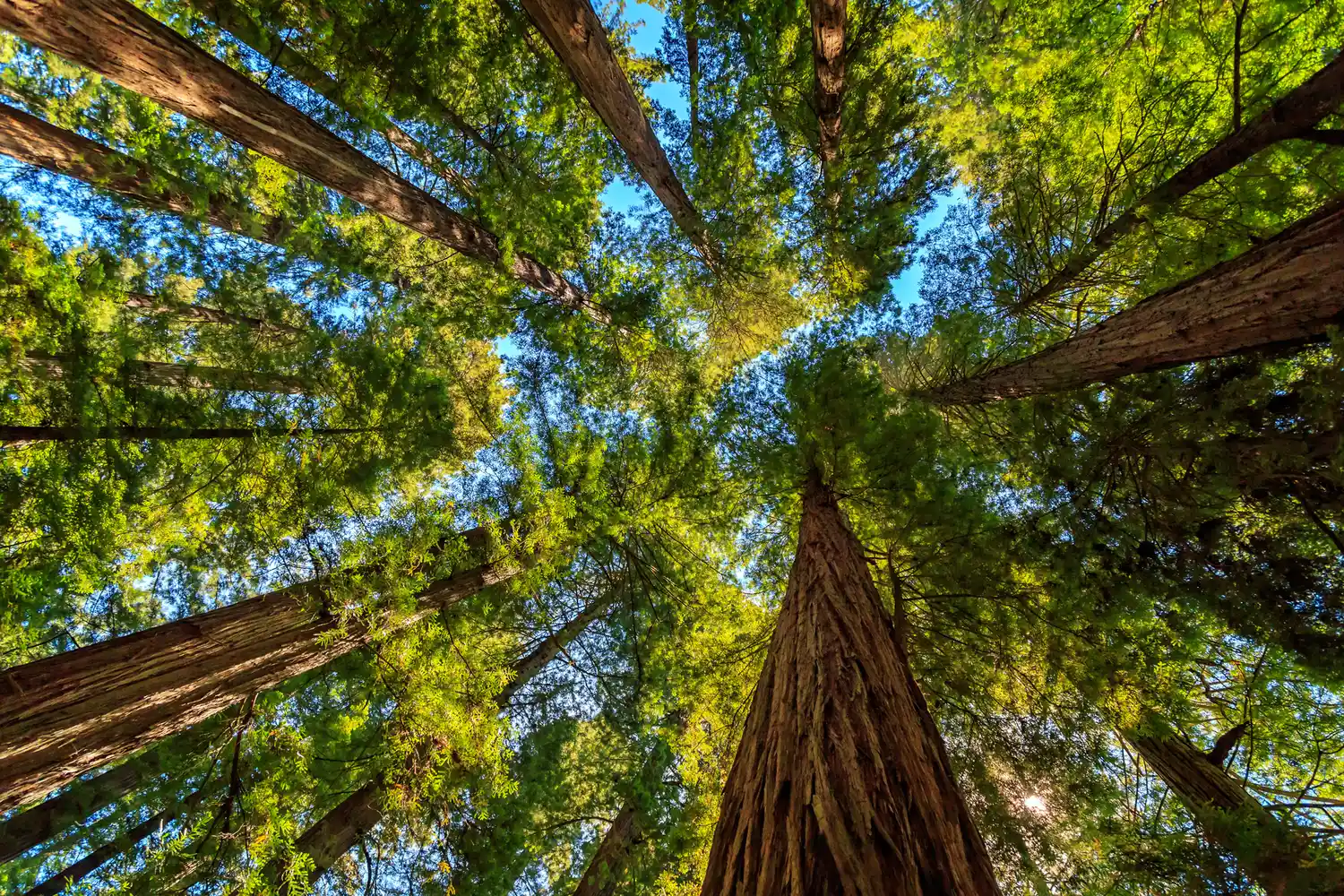
For those seeking a more secluded experience, a short detour onto Mattole Road leads to the Rockefeller Forest. This 10,000-acre section of the park is part of the largest contiguous old-growth redwood forest remaining. Within these woods, Humboldt Redwoods State Park contains more than 100 of the 137 known coastal redwood trees that exceed 350 feet in height. Exploring the short educational trails in Rockefeller Forest and Founders Grove is the best way to see the sheer density of these giants. The Bull Creek Flats area within this forest offers some of the most serene and majestic scenery in the Pacific Northwest, where the silence is broken only by the sound of the wind in the upper canopy.
Seasonal Planning: Best Times & Weather Hazards
Timing is everything when photographing the redwoods. The best time to drive Avenue of the Giants for photography is typically late May through June, or September through early October. During these months, the "God rays" of sun filtering through the morning fog create the dramatic, high-contrast scenes that travelers seek. The summer months bring larger crowds and more traffic, which can make stopping at the narrow scenic pullouts difficult.
Winter offers a different, moodier beauty, but it comes with significant risks. The Eel River is prone to rapid rising during heavy rainfall, and Avenue of the Giants road closures and flood safety should be a primary concern for winter travelers. When the river reaches flood stage, the lower sections of the highway and many access roads to Bull Creek Flats are closed. Furthermore, the park service often removes seasonal footbridges across the river in the late autumn, limiting access to certain hiking trails until the following summer. Always check the weather reports and park service alerts if you are visiting between November and March.
North Reach: Elk Watching & Pepperwood
As the Avenue continues north toward Redcrest and Pepperwood, the forest begins to open up into wider meadows and floodplains. This northern reach offers the best spots to see Roosevelt elk along the Avenue. These massive animals often congregate in the grassy flats near the Eel River in the early morning or late afternoon. While they may appear docile, they are wild animals and should always be observed from a safe distance, particularly during the autumn rut.
In Redcrest, you will find the Eternal Tree House and a variety of small shops offering redwood crafts. This section of the drive feels more pastoral, with the Coast Redwoods standing in galleries along the edge of the river. The final stretch through Pepperwood leads you back toward Highway 101, but not before passing through some of the most photographically stunning miles of the trip. The road here provides several large scenic pullouts where you can pull over and take one last lingering look at the misty forest canopy before returning to the pace of modern life.
FAQ
How long does it take to drive the Avenue of the Giants?
While the road is only 31 miles long, you should allow at least two to three hours for a leisurely drive with several stops. If you plan on hiking the nature loops or exploring the Rockefeller Forest, a full day is highly recommended to fully appreciate the 17,000 acres of old-growth coastal redwoods.
Is there a fee to drive the Avenue of the Giants?
There is no fee to drive the highway or to park at the state park trailheads. However, some private roadside attractions, such as the Shrine Drive-thru Tree and certain walk-thru tree exhibits, charge a small admission fee.
Where does the Avenue of the Giants start and end?
The route begins at the southern end near Phillipsville (Exit 645 off Hwy 101) and ends at the northern end near Pepperwood (Exit 674 off Hwy 101). It runs almost entirely within the boundaries of Humboldt Redwoods State Park.
Are there drive-through trees on the Avenue of the Giants?
Yes, the Shrine Drive-thru Tree is located in Myers Flat along the Avenue. It is a privately-owned attraction that allows small to mid-sized vehicles to drive through a natural opening in a living redwood tree.
Are there hiking trails along the Avenue of the Giants?
There are over 100 miles of trails accessible from the Avenue. Most visitors enjoy the short nature loop trails in Founders Grove and the Big Tree Area, but there are also extensive backcountry trails for experienced hikers in the Bull Creek Flats and Grasshopper Peak areas.
Can you drive an RV or motorhome on the Avenue of the Giants?
Yes, the road is paved and accessible for most RVs and motorhomes. However, the road is narrow and winding in several places with limited shoulder space. Large vehicles should exercise caution when entering and exiting scenic pullouts and may find Mattole Road toward Rockefeller Forest too narrow for comfort.