Quick Facts
- World Ranking: #1 city for the perfect holiday breeze with a 96.4/100 score
- Optimal Temperature Range: Ideal thermal comfort achieved between 23-29°C
- Target Wind Velocity: Perfect conditions require wind speeds of 16-24 km/h (10-15 mph)
- Ideal Humidity: Consistent moderate levels between 65-70% for maximum comfort
- Peak Timing: Arrival at the coast between 11:00 AM and 1:00 PM during summer months
- Geographic Spread: Cooling effects reach inland to suburbs like Parramatta by mid-afternoon
- Atmospheric Signature: Dominated by north-easterly winds and the dramatic Southerly Buster
Sydney is officially the global leader for the most consistent perfect breeze, scoring an unprecedented 96.4/100 in recent meteorological studies. The Sydney sea breeze is scientifically validated as a premium environmental resource, providing optimal thermal comfort and natural ventilation by drawing cool air from the Tasman Sea to combat intense summer heatwaves.
The Science of Perfection: Defining the 96.4 Score
As a geography editor, I often find that travelers discuss the weather as a matter of luck, but in Sydney, the comfort of the air is a matter of atmospheric precision. To understand why this city surpassed every other global destination, we have to look at the scientific criteria for perfect breeze metrics. A study conducted by British Weather Services and AllClear Travel Insurance utilized a rigorous framework to rank global coastal cities. They determined that a perfect breeze isn't just "any" wind; it requires a specific harmony of factors.
Sydney achieved its top score of 96.4 out of 100 because it consistently meets the golden trio of holiday meteorology. The study, led by meteorologist Jim N.R. Dale, identified that the most pleasant air occurs when coastal temperatures between 23-29°C are paired with wind speeds of 10 to 15 miles per hour and relative humidity staying within the 65-70% range.
The engine behind this perfection is the Tasman Sea. During the warmer months, the land heats up rapidly, causing the air above it to rise. This creates a localized low-pressure zone. Meanwhile, the air over the relatively cooler Tasman Sea remains dense and stable. This pressure differential triggers convective cooling, where the fresh maritime air rushes toward the coast to fill the vacuum. Because Sydney sits nestled into a slightly concave coastline, it acts as a geographic funnel, capturing these north-easterly winds and distributing them across the basin with remarkable reliability.
Timing the Relief: When the Breeze Hits the Coast and West
For those planning Sydney outdoor activities around wind patterns, timing is everything. The Sydney sea breeze is not a constant 24-hour presence; rather, it follows a predictable daily pulse that dictates the rhythm of life in the city. On a typical summer day, the coastal suburbs—places like Bondi, Manly, and Cronulla—begin to feel the first stirrings of the ocean air between 11:00 AM and 12:00 PM.
This predictable arrival is the "best time of day for sydney sea breeze" for anyone looking to escape the morning humidity. Research shows that this reliable northeasterly flow generally reaches average speeds of 15 to 25 kilometers per hour, which is the exact velocity needed to evaporate skin moisture without being strong enough to knock over a cocktail or blow sand into your eyes at the beach.
However, the geographic story doesn't end at the shoreline. One of the most fascinating aspects of Sydney's urban microclimates is the penetration of this air mass into the interior. As the afternoon progresses, the sea breeze gains momentum, pushing westward. We see the sydney sea breeze arrival times in western suburbs like Parramatta typically landing between 2:00 PM and 4:00 PM. This delay is why the mercury in the west can often be 5 to 8 degrees higher than the coast during the midday hours, making the mid-afternoon arrival of the ocean air a celebrated daily event for residents of the Greater Western Sydney region.
The best months for consistent sea breezes in sydney are undoubtedly from late October through March. During this window, the land-sea temperature contrast is at its peak, ensuring that the natural air conditioner remains functional even during the most oppressive heatwaves.
Beyond the Sea Breeze: Meeting the Southerly Buster
While the north-easterly sea breeze is the gentle protagonist of Sydney’s climate, the Southerly Buster is its dramatic, sometimes aggressive, supporting actor. Any guide to the local atmospheric conditions would be incomplete without mentioning this unique phenomenon. While the standard sea breeze provides gradual cooling, the Southerly Buster is a rapid-onset frontal change that occurs when a high-pressure system in the Great Bight pushes cold Southern Ocean air up the coast.
Knowing how to prepare for a sydney southerly buster is a rite of passage for locals. These events are often preceded by a hot, still morning with north-westerly winds blowing off the desert. Then, with little warning other than a characteristic dark "roll cloud" appearing on the southern horizon, the wind shifts 180 degrees. Temperatures can plummet by 10 to 15 degrees Celsius in a matter of minutes, and wind gusts can exceed 60 kilometers per hour.
The Great Dividing Range plays a crucial role here, acting as a physical wall that traps the cold air against the coast, funneling it northward toward the city. While it can be destructive to umbrellas and light outdoor furniture, it is the ultimate heatwave breaker. If you are dining out and see the trees suddenly bend toward the north, it is time to grab your jumper; the "Buster" has arrived.
The Local's Guide: Best Spots to Catch the Breeze
To truly appreciate why this city dominates the world rankings for thermal comfort, you have to position yourself at the right geographic "ventilation points." Sydney’s topography offers several prime locations where the wind velocity and maritime freshness are most palpable.
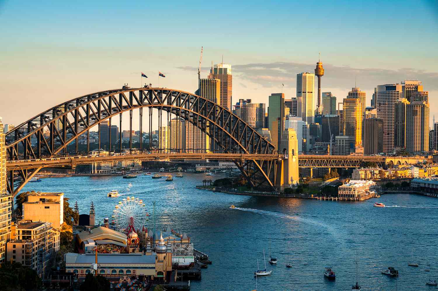
- The Sydney Opera House and Circular Quay: The harbor acts as a natural corridor. Sitting at an outdoor table near the Man O'War Steps allows you to experience the north-easterly flow as it is accelerated through the "Sydney Harbour" pinch points. It is the gold standard for al fresco dining comfort.
- The Bondi to Coogee Coastal Walk: This trail offers constant exposure to the Tasman Sea. Because the path winds along high sandstone cliffs, you are elevated into the path of the cleanest, most laminar air coming off the water, free from the turbulence caused by urban buildings.
- The Northern Beaches: Specifically spots like Palm Beach or the Narrabeen Peninsula. These areas receive the wind directly from the north-east without it having to pass over any land or urban heat islands, resulting in the lowest relative humidity and the crispest feel.
- Barangaroo Reserve: This park was specifically designed with wind flow in mind. The terraced landscaping and proximity to the water's edge create a microclimate that can feel several degrees cooler than the glass-and-steel canyons of the nearby CBD.
Whether you are a researcher looking at the scientific criteria for a perfect coastal breeze or a tourist just looking for a comfortable afternoon, Sydney’s unique interaction between the ocean and the land provides a level of atmospheric relief that is, quite literally, world-class.
FAQ
What time of day does the Sydney sea breeze typically start?
The sea breeze usually begins to manifest in the coastal suburbs between 11:00 AM and 1:00 PM during the summer months. As the land heats up throughout the morning, the pressure gradient increases, drawing the cooler Tasman Sea air inland. By mid-afternoon, this cooling effect typically travels further west, reaching inland hubs like Parramatta.
How far inland does the Sydney sea breeze reach?
The reach of the breeze depends on the strength of the temperature gradient, but it commonly penetrates 20 to 30 kilometers inland. On days with a strong north-easterly flow, the cooling relief can reach as far as the foothills of the Blue Mountains, though its cooling capacity diminishes the further it travels from the coast due to the warming effect of the urban landscape.
What causes the sea breeze in Sydney?
The phenomenon is driven by convective cooling. During the day, the sun heats the land faster than the ocean. The warm air over the land rises, creating a low-pressure area. The cooler, denser air over the Tasman Sea then flows toward the land to replace the rising warm air. Sydney’s concave coastline and the absence of immediate mountain barriers at the shoreline allow this air to move efficiently into the metropolitan basin.
Is a sea breeze different from a Southerly Buster?
Yes, they are distinct weather events. A sea breeze is a regular, daily occurrence driven by local temperature differences between land and sea, usually resulting in a gentle north-easterly wind. A Southerly Buster is a powerful weather front moving up from the south, characterized by a sudden and violent shift in wind direction, a dramatic drop in temperature, and often high-velocity gusts.
Why is the sea breeze important for Sydney's climate?
The sea breeze is essential for maintaining the city's urban microclimates and thermal comfort. Without it, Sydney would experience significantly higher temperatures and stagnating air quality during the summer. It provides natural ventilation that reduces the city's reliance on artificial cooling and helps to disperse urban pollutants, making it a critical factor in the city's high livability and holiday appeal.